 |
Horseshoe-Bend
is the largest town in rural Boise County in southwestern Idaho. As of the 2000 census, the population was 770 residents. The elevation of the town is 2,604 feet above sea level and its named for the horseshoe-shaped U-turn of the Payette River, where the flow direction changes from south to north before heading west to the Black Canyon Reservoir. Horseshoe Bend is one of four incorporated towns in Boise County and is just 19 miles north of the city of Boise. Its a small, but growing, community with friendly people, blue skies and fresh air. The area was originally settled as a gold miners staging area in the 1860s, where prospectors waited along the river for snows to thaw in the higher elevations. After the gold rush settled down, the community became a prosperous ranching and logging community. Today it serves mostly as a "bedroom community" for nearby Boise. Many people enjoy the quiet, rural atmosphere of Horseshoe Bend, yet they are only 30 minutes from the culture, restaurants and shopping of Boise. There are many recreational opportunities in the area, including fishing, hiking, biking, horseback riding, camping. A scenic railroad called Thunder Mountain is also based in Horseshoe Bend. The town is host to a banjo festival in late May, the national senior pro rodeo in June and a fall festival in October.

|
Horseshoe Bend Vacation Rentals
|

|
|
|
|
|
Horseshoe Bend Hotels and Resorts
|
|
|
| | | Hotels & Motels |
| Best Western Salmon Rapids Lodge | 1010 S Main | Riggins, ID | 17.2 mi. | (877) 957-2743 | | Monty's Motel | 700 W Main St | Grangeville, ID | 19.3 mi. | (208) 983-2500 | | Super 8 Motel - Grangeville | 801 SW 1 St St | Grangeville, ID | 19.4 mi. | (800) 800-8000 |

|
Horseshoe Bend Weather & Climate
|

|
|
|
Southwest Idaho has a climate that is characterized as semi-arid with four distinct seasons. Summers are hot and dry and temperatures often exceed 100 degrees F. Winters are cold with moderate amounts of snowfall. Rain is usually infrequent and light, averaging an inch per month. March is the wettest month of the year with an average of 1.41 inches of precipitation. August is the driest month of the year. Spring and fall are generally temperate and quite pleasant. Humidity is low year-round. Rain and snow together in the region average only about 12 inches per year. Spring comes earlier and winter later in this region that is protected from severe weather by nearby mountains.
|
| Month |
High Temp |
Low Temp |
Rainfall |
Ocean Temp |
| January |
40°F |
26°F |
1.18 in. |
- |
| February |
48°F |
30°F |
1.13 in. |
- |
| March |
56°F |
34°F |
1.71 in. |
- |
| April |
65°F |
39°F |
1.78 in. |
- |
| May |
72°F |
46°F |
2.31 in. |
- |
| June |
80°F |
52°F |
1.80 in. |
- |
| July |
90°F |
57°F |
1.08 in. |
- |
| August |
90°F |
57°F |
0.91 in. |
- |
| September |
80°F |
49°F |
1.08 in. |
- |
| October |
66°F |
40°F |
1.12 in. |
- |
| November |
49°F |
32°F |
1.52 in. |
- |
| December |
41°F |
27°F |
1.29 in. |
- |

|
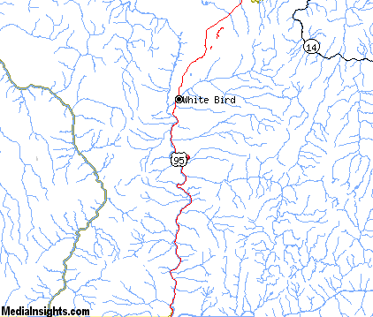
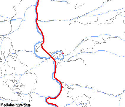
Horseshoe Bend Map & Transportation
|

|
|
 |
|
|
| Click each thumbnail image to enlarge. |
 |
|
 |
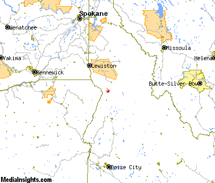 |
The closest airports in the area are the Idaho County airport (S80) located about 20 miles northeast of Horseshoe Bend in Grangeville, Idaho, the Joseph State airport (4S3) located approximately 51 miles west of Horseshoe Bend in Joseph, Oregon, the Mc Call Municipal airport (MYL) located roughly 54 miles south of Horseshoe Bend in Mccall, Idaho, and finally the Lewiston Nez Perce County airport (LWS) located around 60 miles northwest of Horseshoe Bend in Lewiston, Idaho.
|

|
Horseshoe Bend Attractions
|

|
|
| | | Golf Courses |
| Grangeville Country Club | Grangeville | ID | 19.0 mi. | | | Kellogg Country Club | Pinehurst | ID | 29.0 mi. | |
| | | Ski Areas |
| Anthony Lakes | Island City | OR | 88.3 mi. | | | Spout Springs | Weston | OR | 103.8 mi. | | | Lost Trail | Conner | MT | 105.5 mi. | |
Notice a problem with the information on this page? Please notify us.
|
Disclaimer: We recommend you conduct your own research regarding all accomodations and attractions found on this website. The distances shown on this website are straight-line distances as the crow flies. The road distance may be considerably longer. You assume all liability for use of any information found on this website. No information is confirmed or warranted in any way. By using our services you agree to the terms and conditions of this disclaimer.
|
| We are the #1 site for your Idaho Vacation presenting Idaho vacation rentals, hotels, weather and map for each city. |
Idaho Vacation .com
©1997-2024 All Rights Reserved.
|
|